Nature · Guerrero · Chontal people and earlier pre-Hispanic groups · Pre-Hispanic ritual use; national park since 1936
Grutas de Cacahuamilpa
One of the world's largest limestone cave systems, used for ceremonies in pre-Hispanic times and protected today as a national park.
National park (established 1936)
Step through a stone arch tens of meters wide and the daylight ends fast. Inside the Grutas de Cacahuamilpa, slow water has shaped chamber after chamber of limestone, some rooms rising as high as an eight-story building. People have come here for a very long time, first to hold rites, now to walk the lit path and, on some nights, to hear an orchestra play underground.
The story
The caves have a long Indigenous history and several names; the best known is Salachi. The modern name comes from a nearby settlement and means peanut field in Nahuatl.
Their wider fame is usually traced to 1834, when a man named Manuel Sainz de la Pena is said to have hidden inside while fleeing the authorities. Scientific visits followed, the caves opened to the public in the 1920s, and in 1936 the government declared the site a national park.
What you are looking at
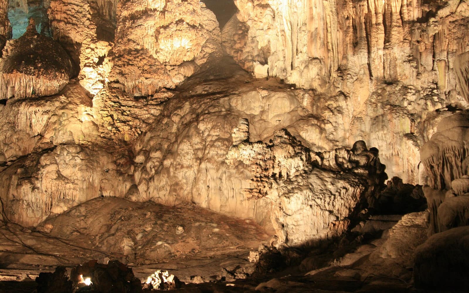
This is a karst cave system, hollowed out of limestone by slowly moving water over a very long span of time. The result is a chain of about ninety large chambers, locally called salons, linked along a passage that runs for kilometers. Roughly twenty of them are lit and open to visitors.
The rooms are big. Many average around forty meters wide, and ceilings reach from about twenty meters up to some eighty meters overhead. Stalactites and stalagmites, columns, and flowstone cover the walls, shapes that guides have long given names.
Two rivers, the San Jeronimo and the Chontalcoatlan, run underground through the park and meet nearby to form the Amacuzac River.
Why it drew ritual use
In pre-Hispanic times the Chontal people held ceremonies and rites inside the caves. Excavations have turned up fragments of pre-Columbian pottery, physical evidence that people used the interior.
Across Mesoamerica, caves were understood as thresholds: openings into the earth and the underworld, tied to water, rain, and the origins of people. That worldview helps explain why a cavern of this scale would have been treated as a charged, sacred place, though the specifics of what was done here are only partly known.
Standing there today
Visitors go in on a guided tour along a paved, lit walkway that runs about two kilometers into the hill and back. The air stays cool and damp, and the lighting picks out the larger formations.
One chamber, called the Auditorium, is used for concerts, most often symphonic music, and sometimes hosts performances tied to Taxco's yearly Jornadas Alarconianas. The caves draw on the order of 350,000 visitors a year.
The park around the caves
The caves sit inside a national park of about 1,600 hectares that straddles the border of Guerrero and Morelos. Above and around the entrance are the two river canyons, a small botanical garden, and marked climbing routes on the cliffs.
The setting near Taxco, a colonial silver town, makes the park an easy day trip and one of the better known natural sites in this part of central Mexico.
Did you know
- Indigenous peoples knew the caves as Salachi; the modern name Cacahuamilpa means peanut field in Nahuatl.
- One chamber, the Auditorium, is used for concerts, most often by symphonic orchestras.
- In 1834 a man is said to have hidden in the caves while fleeing the authorities, which helped spread their fame.
- The San Jeronimo and Chontalcoatlan rivers flow beneath the park and join to form the Amacuzac River.
- Only about twenty of the roughly ninety known chambers are open to the public.
- Regular guided tours have run since 1969, and the caves draw around 350,000 visitors a year.
- The national park covers about 1,600 hectares and reaches across the border into the state of Morelos.
Through time
- Pre-Hispanic era Chontal people perform ceremonies inside the caves; pottery is later found here
- 1834 Manuel Sainz de la Pena reportedly hides inside, spreading the caves' fame
- 1920s The caves open to the public
- April 23, 1936 Declared a national park under President Lazaro Cardenas
- 1969 Regular guided tours begin
Before you go
The park lies off Highway 55 near the Guerrero and Morelos border, about two hours south of Mexico City. Most visitors come by road from Taxco or Cuernavaca, or on an organized day tour.
Open daily; weekday mornings are the quietest. The interior stays cool and humid year round, so timing is about crowds rather than weather.
The standard guided walk covers about 2 km and takes roughly two hours.
Enter only with the official guided tour, stay on the lit path, and do not touch or break the formations. This is a protected national park, so follow the guides and park rules.
Sources: Wikipedia: Grutas de Cacahuamilpa National Park · Show Caves of Mexico: Grutas de Cacahuamilpa · Programa Destinos Mexico: Parque Nacional Grutas de Cacahuamilpa · Atlas Obscura: Grutas de Cacahuamilpa · LAC Geo: Grutas de Cacahuamilpa National Park
Nearby & related
The vast city of pyramids the Aztecs later called “the place where the gods were created.”
Ancient · State of México Hierve el AguaPetrified “waterfalls” of mineral springs, a Zapotec bathing and ritual site for millennia.
Nature · Oaxaca Basílica de GuadalupeThe most visited Catholic shrine in the Americas, on a hill that was sacred long before it.
Sanctuaries · Mexico City Tepoztlán & El TepoztecoA cliff-ringed Pueblo Mágico with a mountaintop pyramid and a long reputation as an energy centre.
Energy · Morelos CholulaThe largest pyramid ever built by volume, now a grass-covered hill topped by a colonial church, with pilgrims still climbing to the summit.
Ancient · PueblaHold ceremony in Mexico?
Each vertical opens with a curation round: verified, or not listed. Tell us who you are, what you hold, and where we can check you.
For practitioners →