Ancient · Yucatán · Puuc Maya · c. 600 to 1000 CE, Late and Terminal Classic Maya
Uxmal
A Late Classic Maya capital in the dry Puuc hills, its limestone palaces covered in masks of the rain god Chaac.
UNESCO World Heritage Site, inscribed 1996, and a federally protected archaeological zone under Mexico's INAH.
In the low limestone hills of the Yucatán, where no river or cenote breaks the ground, the Maya built a city of honey-coloured palaces and covered its walls with the face of the rain god. Uxmal is the masterwork of the Puuc style, a capital that spent its power asking the sky for water.
The story
Uxmal rose in the low limestone hills of the Puuc region in the northern Yucatán. Building on the site began by around the sixth century, but the city reached its height between roughly 700 and 1000 CE, when it became the dominant power of the region.
By tradition it held tens of thousands of people, ruled from grand palaces and joined by causeways to smaller Puuc towns. Within a century or two of its peak Uxmal was largely abandoned as a political centre, for reasons still debated, likely some mix of drought, war, and shifting power across the lowlands.
What you are looking at
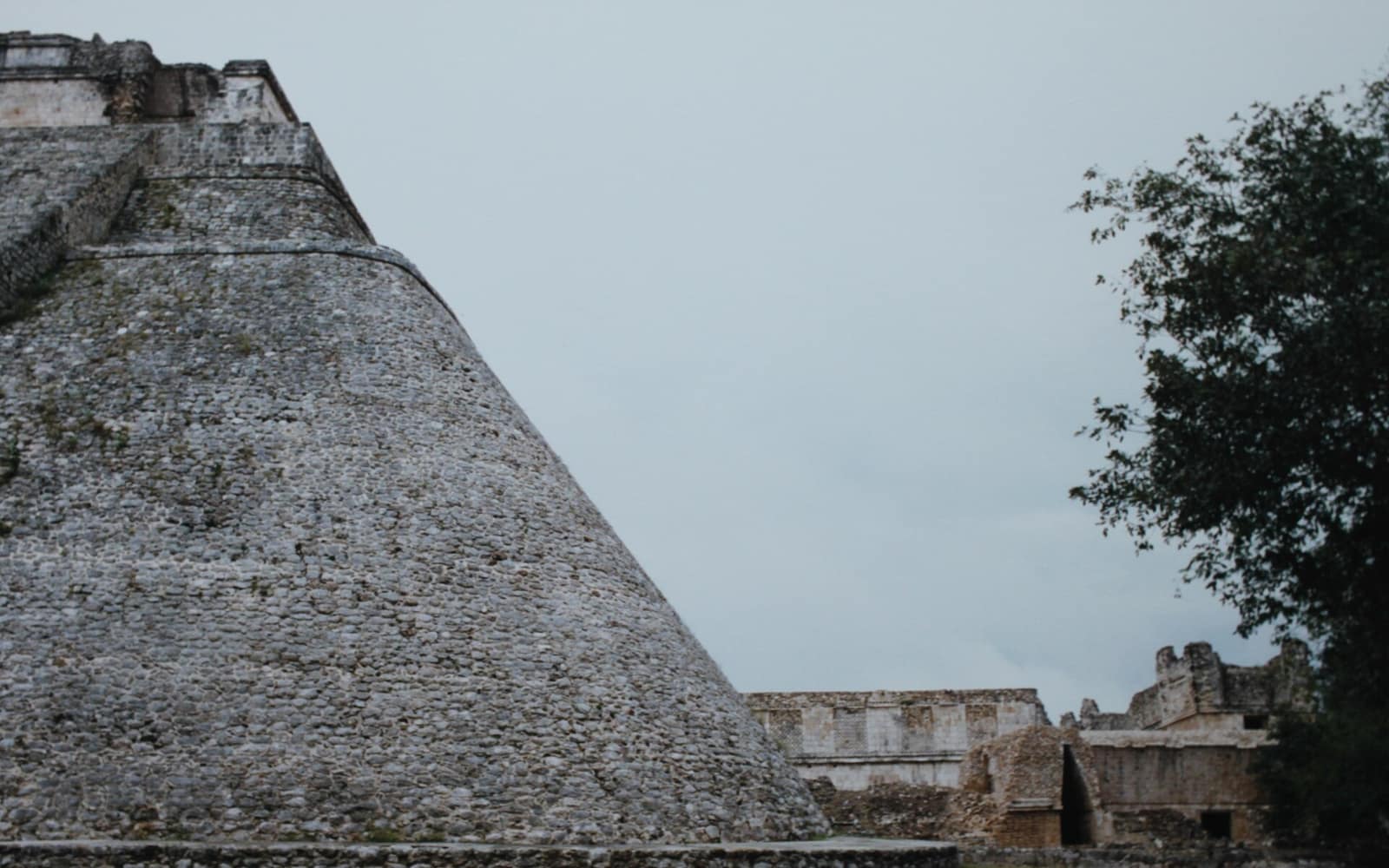
The first thing you see is the Pyramid of the Magician, a tall temple with rounded corners and a rare oval base, built up in several phases stacked over one another. Beside it stands the Nunnery Quadrangle, four long buildings around a courtyard, their upper walls a dense mosaic of lattice, serpents, and rain-god masks.
South across the plaza sits the Governor's Palace, a long low building on a great platform that many consider the masterpiece of Puuc architecture. Close by, the small House of the Turtles carries a carved band of turtles, an animal the Maya tied to rain and the earth.
Why it is sacred
The Puuc hills hold no cenotes, rivers, or lakes. Everything depended on the rain, caught from rooftops and plazas and stored in reservoirs and more than 150 carved cisterns called chultuns.
That is why the face of Chaac, the hook-nosed god of rain and lightning, is repeated by the hundreds across Uxmal's walls. The endless masks read less as decoration than as prayer, a city built to ask the sky for the water it could not draw from the ground.
The legend of the dwarf
A famous legend, written down by the traveller John Lloyd Stephens in the 1840s, holds that the great pyramid was raised in a single night by a magician dwarf hatched from an egg, who then became lord of the city. The Maya still tell versions of the tale.
The archaeology tells a slower story, of many generations of builders reworking the same stone. Both are worth holding at once, the dated fabric of a real Maya capital and the living legend the place still carries.
Standing there today
Uxmal is quieter than Chichén Itzá, and the scale still lands, the honey-coloured stone, the long shadowed galleries, the masks stacked to the rooflines. From the upper terraces the flat green forest runs unbroken to the horizon.
It sits at the head of the Puuc Route, a chain of related sites, Kabah, Sayil and Labná, that can be seen in the same day. Go early, carry water, and give the ruins the care due a place that is both a monument and, to many, still sacred.
Did you know
- The name Uxmal is often translated as thrice built, though its real meaning in Maya is uncertain.
- The Pyramid of the Magician is one of the few Maya pyramids with rounded corners and an oval footprint.
- The Nunnery Quadrangle was named by Spanish friars who thought its many small rooms looked like convent cells; its actual Maya use is unknown.
- The Governor's Palace is oriented toward the point on the horizon where the planet Venus rises, and its facade carries Venus symbols.
- With no cenotes nearby, Uxmal stored its entire water supply as rainwater in reservoirs and more than 150 carved cisterns.
- Uxmal was joined to the cities of Kabah, Labná and Sayil by sacbes, raised roads of white limestone.
Through time
- c. 500s CE Earliest known building on the site.
- c. 700 CE Uxmal grows into a major Puuc town.
- c. 850 to 950 CE Florescence: the Governor's Palace and Nunnery Quadrangle take shape.
- c. 1000 to 1100 CE Decline and gradual abandonment as a capital.
- 1841 Stephens and Catherwood document the ruins for the wider world.
- 1996 Inscribed as a UNESCO World Heritage Site.
Before you go
Uxmal lies about 80 km south of Mérida on Highway 261, reachable by car, guided tour, or bus toward Muna. It is the northern anchor of the Puuc Route, which continues to Kabah, Sayil and Labná.
Early morning is cooler and least crowded. The dry season, roughly November to April, is the most comfortable time to visit.
Two to three hours to walk the main groups; a half or full day if you continue along the Puuc Route.
Stay on marked paths and respect the barriers, as several structures are roped off to protect the stone. It is a national monument and a place many still hold sacred, so treat it accordingly.
Sources: UNESCO World Heritage Centre, Pre-Hispanic Town of Uxmal · INAH, Zona Arqueológica de Uxmal · Encyclopaedia Britannica, Uxmal · Wikipedia, Uxmal · Smithsonian Magazine, The Maya Ruins at Uxmal
Nearby & related
The vast city of pyramids the Aztecs later called “the place where the gods were created.”
Ancient · State of México Chichén ItzáThe Maya city whose pyramid still catches the equinox serpent of light on its steps.
Ancient · Yucatán Monte AlbánA Zapotec capital levelled from a ridge-top, floating above the valley of Oaxaca.
Ancient · Oaxaca PalenqueThe rainforest Maya city of Pakal, where fine stone temples meet the jungle canopy.
Ancient · Chiapas TulumA walled Maya port on a limestone cliff above the Caribbean, and one of the last Maya cities still lived in when Spanish ships first passed by.
Ancient · Quintana RooHold ceremony in Mexico?
Each vertical opens with a curation round: verified, or not listed. Tell us who you are, what you hold, and where we can check you.
For practitioners →